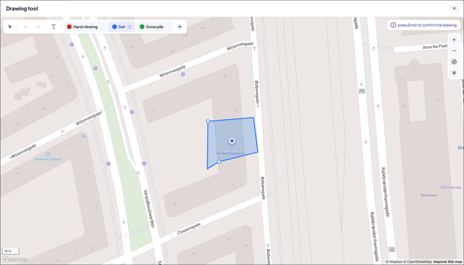
A pin says where an address is; a drawing says what to do there. On the map you outline the car park to plow, the paths to salt, the entrance to keep clear: one drawing per area, each tagged with a work type and a colour.
Draw
-
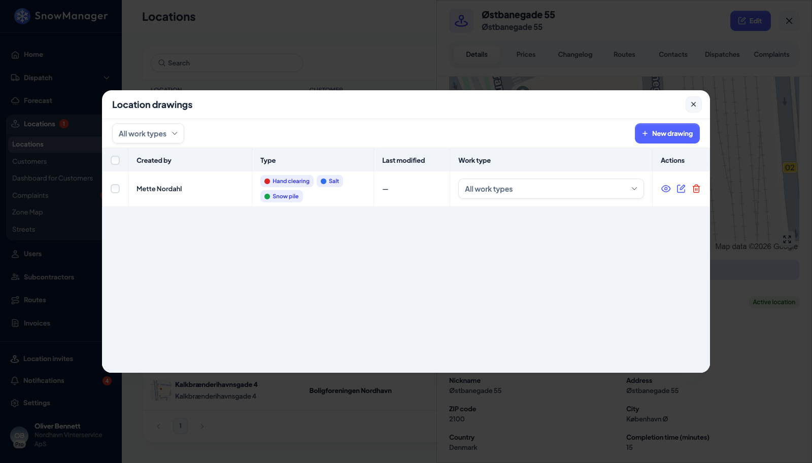
Open the address from Locations and press Drawing tool under its map. The list shows every drawing on the address, per work type. The button is there whether you are reading the address or editing it, and opening the drawing tool from edit mode leaves what you have typed in the form untouched.
-
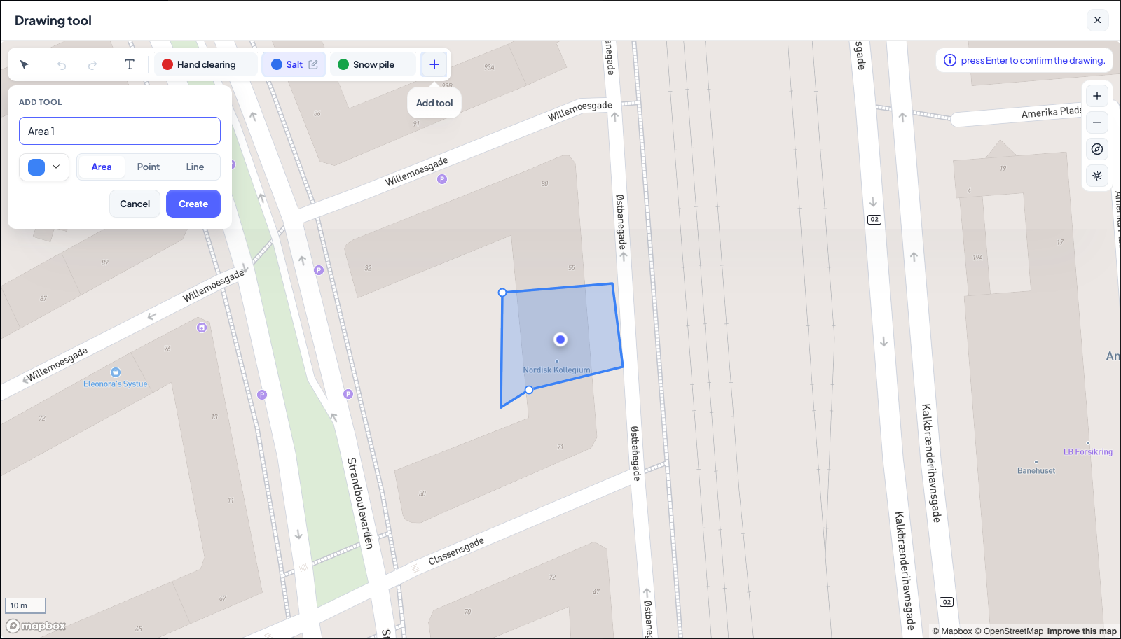
Press New drawing. The map opens with the tools across the top: Select and move, Undo, Redo, your drawing tools as chips, and + to add one.
-
Pick a tool (each has a type, a colour and a price used for offers; they are also kept under Settings → Drawing tool) and choose the Work type the area is for. If you have no tool yet, press +, give it a name and a colour, and pick Area, Point or Line.
-
Click around the area on the map; press Enter to confirm the drawing. Undo and Redo step back and forward; Select and move lets you drag a finished shape or a corner.
The map opens on the address itself, close in and with a dot on the address so you can see which building is which; opening a drawing that already exists frames the whole of it. If the address has never been geocoded there is no dot and the map opens on your company's own address instead.
-
Give it a Drawing name if the default is not telling enough.
Drawings save as you go: the status line says All changes saved (or Couldn't autosave if the connection dropped; try again). There is nothing to press to finish.
Write on the map
Some things about an address are not a shape: the gate code, which entrance the key opens, that the ramp is heated and must not be salted. Add text label on the toolbar puts that on the map as writing.
- Press Add text label and click where the text should sit. A box asks what it should say.
- Type the caption and press Save (Ctrl+Enter saves, Escape abandons). Enter starts a new line, so a label can say "Gate 4" over "code 1234".
- Double-click a label to change what it says. Select and move drags it somewhere else; Delete removes the selected one, and so does saving it with the text emptied.
A label is drawn as black text on a white card, and it looks the same everywhere the drawing is shown: here, on the route map, on the live map and in the driver's app. Unlike an area or a line it belongs to no drawing tool, so it needs none configured, it has no colour to pick, no work type, no price and no m²: it is a note on the map, not work to be done. That also means it never counts towards a geozone, so writing "car park" on a car park is not the same as drawing it.
Download the drawing as a picture
For a customer, a tender or a crew briefing, the drawing can be saved as an image.
- Open the address. Its Details tab shows the address on a map with the drawing painted on it, and the drawn areas as chips underneath.
- Frame the map the way you want it in the picture, satellite view included if you switched it on.
- Press Download at the end of the row of areas (Download the drawing as an image, with its areas).
You get a PNG of the map as it is framed, with the drawing, its text labels, and the areas as a
legend under the address's name. The file is named after the address, the word drawing and
today's date, for example Lego_drawing_2026-09-15.png. An address without a drawing has the
button greyed out: This address has no drawing to download.
Why the drawings matter
- For the driver. The app shows the drawn areas on the stop, in their colours, so a new driver knows what "clear the car park" means at this address.
- For the size of the job. Each drawing has an area in m²; offers are priced from it, and the location's Areas column in the list sums it up.
- For the GPS. The union of an address's drawn areas is its geozone: when a driver's phone reports a position inside it, or within 15 metres of it, the stop is checked in, and when the phone has been outside it for five minutes, checked out. Those 15 metres cover the vehicle parked at the edge of what it clears and the usual GPS error; they are not drawn, so draw the area you want cleared, not a wider one. A drawn line counts as well: within 20 metres of a curb or path drawn with the line tool is at the stop, so an address with only lines still registers. An address with no drawing falls back to a 40-metre circle around its pin (fine for a villa, too small for a business park). If GPS check-in is not firing for an address, the first thing to check is whether its drawings cover where the drivers actually are.
Per work type
A drawing belongs to one work type. The same car park can have a plowing drawing and a salting drawing on top of each other; the driver sees the ones for the work type of the dispatch. All work types in the drawings list shows everything at once.
Who can draw
The owner of the address and the subcontractor assigned to it can both add drawings; each sees the other's. A drawing can be deleted from the drawings list. Are you sure you want to delete this drawing? This action cannot be undone. means exactly that.